Balloon Mapping Garfield Park Gardens: Epic Fail
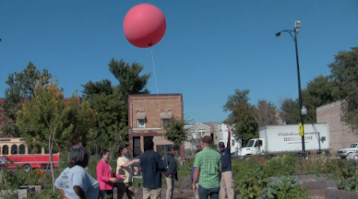
This past week CivicLab partnered with Freedom Games and Angela Taylor of the Garfield Park Garden Network to map their community garden at 2900 W. Madison, along with students from West Town High School.
The previous weekend, using the grassroots balloon mapping kit developed by the Public Lab, we had a successful test mapping of a 200 ft sand labyrinth built by artist Matthew Lavoie of Chicago Labyrinths.
This time it was an epic fail. Lessons learned?
1) Just because it’s called a pre-flight checklist, doesn’t mean it’s meant to be checked literally just before the flight at the site. Go through it before you leave the site (read: left extra batteries at CivicLab).
2) Sending up a camera housed in a soda bottle attached to a giant balloon with tiny puncture sealed by gaffer’s tape will give you enormous anxiety when the wind pushes it into the airspace of oncoming traffic.
3) Do test photos at 100 feet every time you send the balloon up, not just the first time. Our second set of photos from 500ft were completely washed out.
On the plus side, we returned a few days later to take some amazing footage of the fruits of their garden using a Canon Power Shot A490 with the infrared filter removed. We added a roscoe #2007 blue filter to create our own Infrablue camera. Developed by the Public Lab, images processed from this hacked camera can give us a the Normalized Difference Vegetation Index (NDVI). Check out these images of tomatoes, eggplants and flowers!
